
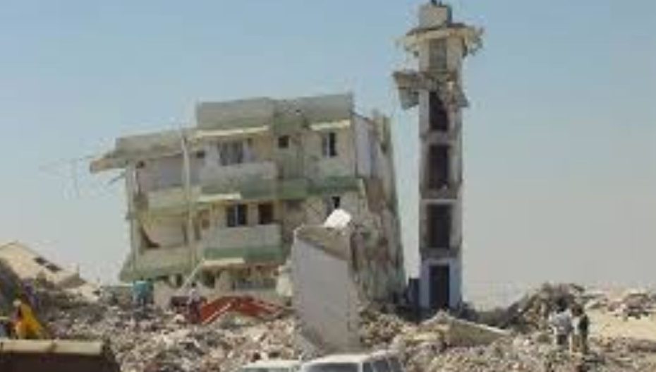
This January Gujarat will observe 25 years of the 2001 earthquake that shook Kutch and the state to its core.
Called the worst in decades, it was an unprecedented calamity for the state that resulted in over 13,800 deaths.
Measuring 7.7 on Richter scale, the energy released was reportedly equivalent to 400 atomic bombs thrown over Nagasaki, exploding 23 km below the earth’s surface.
And now, fresh research has analysed why Kutch remains vulnerable to earthquakes.
The answer lies deep beneath the surface, scientists concluded.
Multiple fault lines and crustal deformations interact within the Earth’s crust, triggering repeated tremors, a national daily reported.
The study was carried out by researchers from the Institute of Seismological Research (ISR), Gandhinagar, and Maharaj Agrasen University in Himachal Pradesh.
It examined more than 1,300 tremors recorded between 2008 and 2024. Data from 56 permanent and 20 temporary seismic stations were used to scan the crust beneath Gujarat and identify tectonically active zones.
Titled ‘Complex nature of the crustal anisotropy in the western margin of the Indian subcontinent and its geodynamic implications’, the study was published in the latest issue of Elsevier’s journal Tectonophysics.
The authors include Sowrav Saikia, Rakesh Prajapat, Sumer Chopra, Santosh Kumar, Vinay Kumar Dwivedi of ISR, and Vikas Kumar, who is affiliated with both ISR and Maharaj Agrasen University.
Saikia said the most striking finding of the study related to the Kutch region.
Kutch is a rift basin. The deformation is high. Higher than anywhere else in Gujarat. The pattern is clear. The deformation lines up with major active faults. Kutch Mainland Fault. South Wagad Fault. Allah Bund Fault. Gedi Fault. These faults have caused big earthquakes earlier, the research concluded.
The study notes that Kutch has witnessed at least four earthquakes of magnitude 6 or higher on the Richter Scale. In 1819, a magnitude 7.8 earthquake struck the Allah Bund region.
Saikia explained that the researchers examined crustal anisotropy, or deformation, to determine whether it followed major fault systems or reflected local fault structures.
He was quoted as saying that in Saurashtra and the Narmada rift basin of South Gujarat, deformation patterns closely follow local faults, while in North Gujarat and the Cambay rift basin, the deformation aligns more with the overall movement of the Indian plate towards the Eurasian plate.
Some areas shake more often. Many faults operate in a small space. Stress builds up. It stays locked in the crust.
The researchers said that while the study was not aimed at prescribing changes to existing seismic vulnerability assessments or building codes, it provides a scientific framework to examine deformation and stress perturbations within the Earth’s crust.
They added that by identifying zones of active deformation and their controlling fault systems, the findings offer valuable inputs for earthquake hazard assessment. Such information, they said, can be integrated with engineering, urban planning, and risk studies to improve preparedness.
Also Read: Mild Earthquake Tremors Recorded In Gujarat & Kutch https://www.vibesofindia.com/quake-tremors-in-kutch-and-gujarat/