

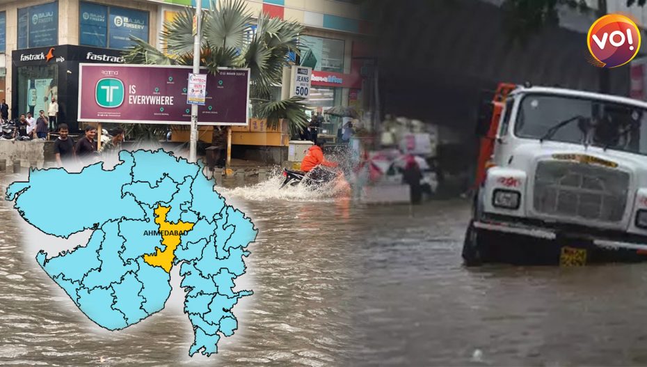
An hour of heavy downpour in the west zone areas of Gujarat’s Ahmedabad city could have led to waterlogging-like situations near Helmet Circle, Valinath Chowk, AEC Circle, Naranpura Crossroads, RTO and Lakhaudi Talav Circle.
In just 60-minutes of rain, the city reported a waterlogging-like situation across many areas and stumped the traffic movement across the city.
The west zone also covers the city’s central business district (CBD) Ashram Road, the Gujarat University area, Navrangpura, CG Road, Paldi, SP Stadium, and Chandkheda-Motera belt.
According to a study conducted by the Indian Institute of Remote Sensing (IIRS), Dehradun, nearly 55 percent of the area of AMC’s West Zone comes under flood-prone regions.
The study suggested that setting-up an integrated Blue-Green Infrastructure (BGI) in such areas with dense developments could be an alternate solution.
The study added that BGI will also have environmental benefits.
The Blue-Green Infrastructure (BGI) is a landscape conservation method that covers networks of lakes and green spaces, permeable pavements, bioswales, rain gardens, urban tree cover, small ponds, and wetlands.
A BGI approach argues for the sense and sustainability in employing more integrated systems-thinking in the management of water and green spaces in the urban environment.
Additionally, it also proposes a feasible and valuable solution for urban areas facing the challenges of climate change.
Researchers Ravnish Kaur and Kshama Gupta of the IIRS have provided a potential map, marking the suitability of a BGI network for the west zone.
The core map suggested that- ‘Of 450 square-kilometres of the city, about 145 square-kilometre (32 percent) has low suitability, nearly 157 square-kilometre (35 percent) has moderate suitability and the rest 148 square-kilometre (33 percent) has the highest suitability.
While carrying the study, areas larger than two hectares were considered under study for BGI networks.
Saswat Bandyopadhyay, Project Director, Centre of Urban Planning and Policy (CUPP), CEPT Research and Development Foundation, said- “Ahmedabad needs a sea change in the planning process to implement BGI. While we still hinge on floor space index (FSI) in the planning process, in Europe, the US and Singapore, planning involves the green plot ratio (GPR).”
He added that AMC should include stormwater drainage technologies that slow the speed of surface runoff in its infrastructure.
Stressing on the political will in formulating such plans within the city, Bandyopadhyay said, “We can make cities climate resilient only if there is a strong political will and thorough knowledge of the ground realities of town planning in Gujarat cities.”
Bandyopadhyay added that the construction industry in Ahmedabad had begun including elements such as vertical gardens and green roofing.